The Drifts of Meiringspoort
The drifts are numbered from the southern (De Rust) entrance.
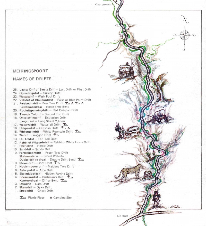 Meiringspoort Drifts map from Helena Marincowitz's book
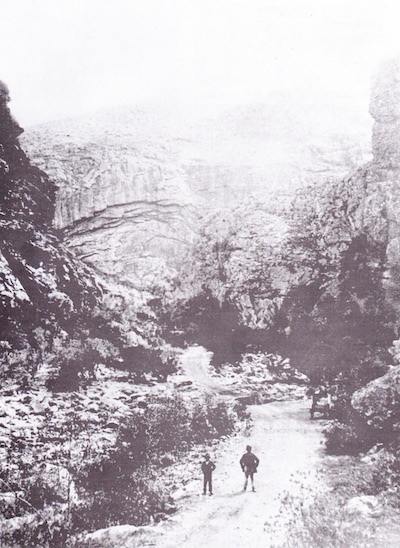 The old road through Meiringspoort1. Spookdrif (Ghost drift): A supernatural light, in the form of a ball of fire was seen at this drift.
2. Skansdrif (Dyke drift): Stone ramparts are often built in the river bed to keep storm water from flooding fields. The first primitive ramparts were frequently washed away, but now more effective method envelopes the stones in a steel mesh.
3. Damdrif (Dam drift): Immediately upstream from this ford was a large waterhole. It was very deceptive, especially to strangers and vehicles were frequently bogged down. Just to the west of the river-bank, the Centenary Monument was erected. At the next drift on the old road there was a sharp bend, known as Kantoordraai (Office Corner) where many vehicles collided, resulting in several court (office) cases. Between Dam drift and Bushman’s drift there are two picnic spots, without ablutions.
4. Boesmansdrif (Bushman’s drift): Just beyond this place, to the west, there are broad, deep clefts in the rocks, where Bushmen lived. As late as 1965 their artefacts were still found. Today this area is overgrown by fig trees.
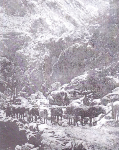 Ox wagon in Meiringspoort 1878
5. Skelmkloofdrif (Hiddenravine drift): On the eastern side of this drift there is a well hidden ravine. From here water trickles down the rock face into the Groot River. There is a legend that layabouts (in Afrikaans “skelms”) living in this ravine stole Petrus Meiring’s sheep.
6. Aalwyndrif (Aloe drift): Against the north face of the cliff overhanging this ford, there are beautiful mountain aloes (Aloe giganticus), which bloom from July to September. In the days of itinerant traders these aloes grew so densely that a man stopped here to tap and boil the sap, which they then sold as a much sought – after medicine. Here is also a very nice picnic spot with ablution and braai facilities.
7. Nooiensboomdrif (Maidens Tree drift): This name originated from the two big Kiepersol trees (maiden trees) that grew on either side of the road, their branches intertwining. Between this ford and the next there is a peaceful lay-by with the expressive name “baboon’s waterfall “(bobbejaan’s waterval)
8. Steweldrif (Boot drift): Tradition has it that Petrus Meiring’s wagoner’s boots were washed away here, causing him to return home for another pair. Dubbeldrif (Double drift) disappeared with the building of the tarred road. Here Roy Petersen raised the surface of the road five meters above its old bed, gutting out Double drift. However the name has been transferred to the bend, now known as Dubbele drif se draai (Double drift corner).There is a rock formation at Double drift that resembles a pointing finger. After an accident where a man and his wife were drowned it was said: “Look, the finger is pointing to where the couple drowned because they were driving on a Sunday”. During the great ostrich-feather slump of 1914, an insolvent local man committed suicide by hanging himself from the “finger rock”. A little further on, to the east, is the Skelmwaterval (Secret waterfall), to be seen after good rains in the mountains.
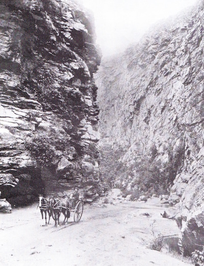 Horse cart crossing one of the streams at Double Drift
9. Perskeboomdrif (Peach Tree drift): Once a few peach trees grew at this ford, probably from pips discarded by passers-by. According to Ryk Meiring, the baboons were the only ones who ate the fruit. These trees have now vanished, but the name remains.
10. Sanddrif (Sand drift): Obstructions caused by sandbanks frequently occurred at Sand drift. In 1948 the first concrete causeway was built here. A little further on, on the western side, is the well known “Herrieklip” (Herrie’s Stone).
11. Herrie se Drif of Nagasdrif ( Herrie’s or Naga’s drift): This drift, just beyond Herrie’s stone, was first known as Naga’s drift named after Nagas, the chief of the Bushman tribe that lived higher up in the deep recesses. After 1929, when Herrie had been chiselled into the stone, the change of name came naturally. Herrie’s Stone was declared a National Monument on 3 August 1971. The name Herrie was chiselled by Langenhoven as a monument to the imaginary elephant from his story “Herrie op die Tremspoor”.
![Herrie Stone in Meiringspoort By A3alb
https://creativecommons.org/licenses/by-sa/3.0)], from Wikimedia Commons Herrie Stone in Meiringspoort By A3alb
https://creativecommons.org/licenses/by-sa/3.0)], from Wikimedia Commons](../../attachments/Image/Herrieklip_Meiringspoort._1873-1932._4.jpg?template=generic) Herrie Stone in Meiringspoort By A3alb
https://creativecommons.org/licenses/by-sa/3.0)], from Wikimedia Commons
Herrie Stone in Meiringspoort By A3alb
https://creativecommons.org/licenses/by-sa/3.0)], from Wikimedia Commons
12. Witperdedrif of Rabbi se drif (White horse or rabbi’s drift): A rabbi was washed downriver here with his horses and cart. History does not tell what happened to the rabbi. According to Ryk Meiring, all that was ever found were his coat and religious vestments. Another version is that the name owes its origin to the drowning of two white horses during the 1915 flood.
13. Our Toldrif (The Old toll drift): Although the old Toll-house has vanished, its name remains.
14. Wadrif (Wagon drift): A number of wagons were washed away at this point. To the west of the ford is a smoke-blackened rocky overhang where Gerolm Marincowitz (1805-1890 farmed at Vrolikheid (Klaarstroom). He was one of the foremost petitioners for a road through Meiringspoort.) Set up his smithy to maintain the tools used in the building of the “boer road “(1885). Probably because of this association this site was later known as The Bellows. It is a popular place to picnic.
15. Witfonteindrif of Withuisiedrif (White Fountain drift or White house drift): A strong, perennial stream of crystal-clear water has its source high in the mountains to the west. Flowing down the slopes of the ravine, these streams enter the Groot River just before the drift. A cement-lined pool is situated near the tarred road with a little pump house alongside. In the 1990’s this was known as “buswatertjie” because buses frequently stopped here for water.
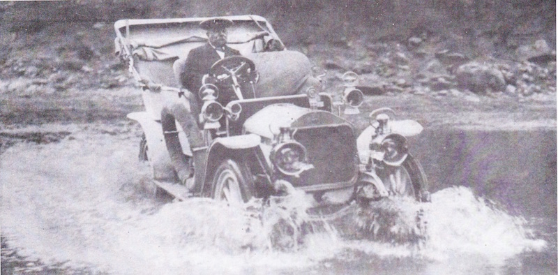 Dr. Russel of Oudtshoorn in his 1902 Wolseley Siddeley crossing one of the drifts in Meiringspoort
16. Uitspandrif (Outspan drift): At this ford the wagoner had space to out span his team of oxen. Today a neatly laid-out picnic site with ablution and braai facilities is conveniently near to the Great Waterfall.
17. Waterval drif (Waterfall drift): Waterfall drift is named after the nearby waterfall. Langstraat (Long Street), a stretch of road with no river crossings comes after this drift (2,9km). Again a nice picnic spot with ablution facilities.
18. Ontploffingsdrif (Explosion drift): A wagon loaded with dynamite is believed to have travelled at such a speed over the bumpy “boer road” that its freight exploded spontaneously at this ford. The wagon and mule-team did not survive, but miraculously the driver did. The old “boer road” can be seen on your right hand side. At this bend English soldiers fighting in the Anglo-Boer War (1899 - 1902) built a fort with stone walls.
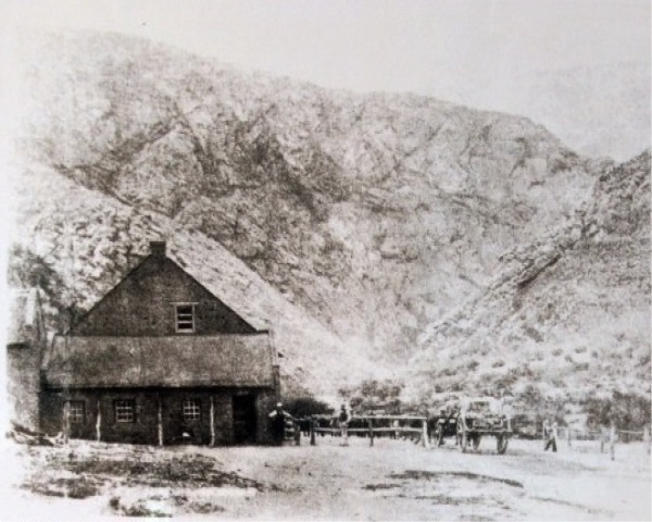 Rankin’s Toll Gate at the Southern Entrance to Meiringspoort 1876
19. Toldrif (Tollhouse drift): Nowadays marked as Third toll drift. This was the third toll-house in the Poort. The second Toll was ruined with the rebuilding of the road.
20. Rooiuitspanning of Langstraatdrif (Red outspan or Longstreet drift): To the right of this ford there was room enough for a number of wagons to out span. The name originated from the red colour of soil. Here was the ending of Long Street which was mentioned earlier.
21. Pereboomdrif (Pear tree drift): An enormous saffron pear tree grew nearby making this a popular gathering place and out span. Along the road was a house where two spinsters lived. When one died the other spinster buried her in the dining room. The survivor disappeared without anybody seeing her again. Here you can find two picnic sites located at each side of the drift, with ablution and braai facilities.
22. Bloupuntdrif of Wasgatdrif (Blue point rift or Wash-pool drift): Just before this drift a turn-off leads to the farm Blue Point (Bloupunt), which later gave its name to the drift. At this drift, wagoners coming from the Great Karoo encountered the first really deep pools. Here water barrels could be filled and the dust of the Karoo washed off.
23. Valsdrif (False drift): Wagon-teams frequently got stuck in this ford because of the loose gravel and deep sand drift.
24. Opmetingsdrif (Survey drift): In 1912 a survey was done to decide whether to build a dam across this ford, the narrowest point in the gorge.
25. Laaste drif of Eerste drif (Last or First drift): Depending on which way you are travelling, this is either the first drift southwards or the last drift northwards.
All the picnic spots and ablution facilities are well maintained and serviced regularly.
The information about the Drifts of Meiringspoort, including the map, was sourced from Helena Marincowitz’s book: Meiringspoort: A scenic gorge through the Swartberg range. This can be purchased at the Fransie Pienaar Museum in Prince Albert and can be ordered directly from the Museum on the following:
Phone: 023 5411 172
Email: fransiepmuseum@lantic.net
FOLLOW THESE LINKS FOR INFORMATION ON MEIRINGSPOORT'S
GEOLOGY FLORA FAUNA THE DRIFTS THE GREAT WATERFALL


